Took this shot just last month at Camp Richardson on the South Shore of Lake Tahoe -- which, I've just learned from InciWeb, has been evacuated because of the fire that has consumed 3,100 acres of the surrounding area, and is still raging at full speed. (Note the dry tinder pine needles that are everywhere in this shot -- and everywhere around Lake Tahoe, where the fire hazard was at "very high" or "extreme" while we were there.)
I didn't know it when I booked it, but my mother and her family spent two weeks every summer at Camp Richardson when she was a kid. This last month we got ourselves a small cabin called "Willy's Knight" (I really don't know why it was called Willy's Knight -- strange name for a cabin) that was just a stone's throw from the water, with a sweet little porch that was perfect for sipping coffee (while wearing a kick ass cowgirl hat) and watching the sun rise over the lake.
I don't know if it'll be there in the morning.
Showing posts with label lake tahoe. Show all posts
Showing posts with label lake tahoe. Show all posts
Tuesday, June 26, 2007
Wednesday, May 30, 2007

Tuesday, May 29, 2007

Monday, May 28, 2007
desolation wilderness
Hiked up to Horsetail Falls in California's Desolation Wilderness the day before last -- or almost. The trailhead is just before Twin Bridges off HWY 50 headed out of the South Shore of Lake Tahoe, and the first part follows the effluence of the falls, where it scatters broad and bright across granite stairsteps and churns up full of light and air.
The hike itself is mostly a hard rock scramble across broad granite slabs, interspersed with a few brief dirt trails. Wayfinding changes all together when you're climbing right on rock -- there are no footprints from the folks who went before to reassure you that you've found the right way, no worn tracks to indicate direction.
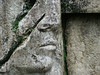
On this trail there was a periodic marker on the occasional tree, but mostly the way was marked by cairns: those stumpy little piles of rock that signal human intent and seem so generous and kind when there's nothing else to show you the way.
At the top of the loop, about an hour in to our hike, the good folks from the Park Service have posted a second box, like the one at the first trailhead. But this one asks you to fill out a wilderness permit, and sign to indicate that you realize you're about to enter an area where the trails are not maintained, where the risks are higher and where extra caution is required.
Having planned for only a day hike we were entirely unprepared to forge into the wilderness, and being reckless and (relatively) young we thought "sure: why not" and filled out the form and headed up the trail.
Okay, here's why not: because it's frickin' wilderness.
In a terrain where what few markers you had have fallen away and you're left with only rock and rivers and the rare dirt path you need a topographical map to get you through something like that. And a better compass than the one we had.
We had the Falls in our sights and used that where we could to stay in line with our destination, but it did us no good when suddenly the rock would fall away where it had been cleaved centuries before by some strong freeze cycle or glacial action. We'd double back, and double back again when we encountered the next big drop off. By this time others were hunting and pecking their way up the same trail, using pretty close to the same methods we were.
At one point we spotted a party who were being led by a fairly confident looking fellow, so we started up after them -- only to have them circle back on us when they hit the next steep drop-off.
If we'd had 1) all day 2) a topographical map and 3) provisions enough to get lost on, we might have stayed at it a little while longer. But we had a wedding to get to before too long, and our whole lives ahead of us, so after 30 minutes or so of scrambling through the wilderness and progressing only a few feet we called it a day and headed out again, picking our way through the cairns.
The moral of this story: It's good to get lost in the wilderness sometimes, but it's better if you give yourself plenty of time and pack some snacks.
Posting by cameraphone from the South Shore of Lake Tahoe.

The hike itself is mostly a hard rock scramble across broad granite slabs, interspersed with a few brief dirt trails. Wayfinding changes all together when you're climbing right on rock -- there are no footprints from the folks who went before to reassure you that you've found the right way, no worn tracks to indicate direction.
On this trail there was a periodic marker on the occasional tree, but mostly the way was marked by cairns: those stumpy little piles of rock that signal human intent and seem so generous and kind when there's nothing else to show you the way.
At the top of the loop, about an hour in to our hike, the good folks from the Park Service have posted a second box, like the one at the first trailhead. But this one asks you to fill out a wilderness permit, and sign to indicate that you realize you're about to enter an area where the trails are not maintained, where the risks are higher and where extra caution is required.
Having planned for only a day hike we were entirely unprepared to forge into the wilderness, and being reckless and (relatively) young we thought "sure: why not" and filled out the form and headed up the trail.
Okay, here's why not: because it's frickin' wilderness.
In a terrain where what few markers you had have fallen away and you're left with only rock and rivers and the rare dirt path you need a topographical map to get you through something like that. And a better compass than the one we had.
We had the Falls in our sights and used that where we could to stay in line with our destination, but it did us no good when suddenly the rock would fall away where it had been cleaved centuries before by some strong freeze cycle or glacial action. We'd double back, and double back again when we encountered the next big drop off. By this time others were hunting and pecking their way up the same trail, using pretty close to the same methods we were.
At one point we spotted a party who were being led by a fairly confident looking fellow, so we started up after them -- only to have them circle back on us when they hit the next steep drop-off.
If we'd had 1) all day 2) a topographical map and 3) provisions enough to get lost on, we might have stayed at it a little while longer. But we had a wedding to get to before too long, and our whole lives ahead of us, so after 30 minutes or so of scrambling through the wilderness and progressing only a few feet we called it a day and headed out again, picking our way through the cairns.
The moral of this story: It's good to get lost in the wilderness sometimes, but it's better if you give yourself plenty of time and pack some snacks.
Posting by cameraphone from the South Shore of Lake Tahoe.
Saturday, May 26, 2007
dew point
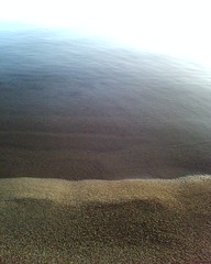
My uncle sails and sometimes races, and he told me once about an overnight run: about the peace of the moon on the water, the still quiet, the way the wind can run soft through the evening. He told me about bundling up to keep the chill off, but he said it's no use when the dawn comes, because with the dawn comes the dew, and "there's no escaping the dew."
That's because you can't ward off the dew like you can slack off rain with a slicker: the dew soaks surfaces without ever first passing through the sky. Tiny droplets, always present in their potential, that appear spontaneously when the right temperature and moment collide. Demanding your notice. Soaking you to the bone.
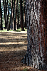
Posting this a little after dawn from the South Shore of Lake Tahoe. Sitting on a rickety old rustic porch, drinking strong coffee, where only a few regal Ponderossa and a couple of geese separate me from the shore. Was down there walking at the water's edge just a little while ago, bathed in the scent of the pine woods.
Redolent. Constant.
That's because you can't ward off the dew like you can slack off rain with a slicker: the dew soaks surfaces without ever first passing through the sky. Tiny droplets, always present in their potential, that appear spontaneously when the right temperature and moment collide. Demanding your notice. Soaking you to the bone.
Posting this a little after dawn from the South Shore of Lake Tahoe. Sitting on a rickety old rustic porch, drinking strong coffee, where only a few regal Ponderossa and a couple of geese separate me from the shore. Was down there walking at the water's edge just a little while ago, bathed in the scent of the pine woods.
Redolent. Constant.
Subscribe to:
Posts (Atom)