Where am I? Where do I want to go? How do I get there?
—What Maps Tell Us, per the Field Museum
Maps, Finding our Place in the World, which opened up at Chicago’s Field Museum on November 2nd, is a peep show for the schematically inclined.
Caught it last night in a private showing put on by the good folks at the Anthropology Alliance, who also brought in Ryan Williams, one of the show’s curators, to speak on the technologies of mapping. (The buffet, for those who care most about these things, pulled in a meager 3 points out of 5. Full points for the open bar were offset by the unidentifiable Satay, which may or may not have been poultry product. Admittedly the score would have plummeted to 2.5 if the desserts weren’t as solid as they were: mini-carrot cakes, lemon bars and a molten brownie glazed in frosting, sprinkled with jimmies, and vaguely reminiscent of an uptown Hostess ding dong)
But to the exhibit.
All the big guns were there: Lindbergh’s Flight Chart for his historic New York to Paris trek. The first Mercatur projection (I know -- get out!). Cook’s chronograph (although no word on whether it was with him during that unfortunate incident in the Sandwich Islands in which the locals mistook him for Lono -- the second time).
Edmund Halley’s 17-hundred-something map of the magnetic North -- the very first graphical representation of the earth’s magnetic field, bifurcated by the lovely curvilinear “line of no variation” -- also put in an appearance; and Cortes’ map of the Aztec capitol he conquered was also in attendance.
Even a 15th century rendering of Ptolemy’s Geographia was there.
Fans of Edward Tufte will be sure to recognize John Snow’s 1855 Cholera Map of London and Minard’s Figurative Map of the Successive Losses in Men of the French Army in the Russian Campaign 1812-1813.
The freaking cool North/South digital military map of the Civil War conflict from the Lincoln Museum in Springfield, which I wrote about back in August of last year, was there, although it lost some of its impact on the small screen that it was afforded (about twelve inches across -- in Springfield it fills a wall).
Thomas Jefferson and Benjamin Franklin also put an appearance, mapping colonies and the Gulf Stream respectively, but it was the more obscure gems that were ultimately the most interesting.
- Places Visited by Emperor Yu by an unknown Chinese mapmaker in 1136 was one of the first maps to use uniform scale to represent distance. The map itself is carved in wood -- copies were made via ink rubbings. The image is a strict grid -- solid blocks of black outlined in concave lines of white -- intersected and overrun by the sinuous meanders of what I assumed was the Yangtze, but realize now that I failed to write it down
- A map of Oaxaca, Mexico, when it was still called Amoltepec -- drawn just like you would expect a Mixtec artist would draw it on paper in 1580 -- hauntingly reminiscent of the few remaining Mayan Codices
- A map drawn from memory by Wetallok, an Inuit, of the Belcher Islands in Canada, on request for Explorer Robert Flaherty, that in its harsh expressionistic lines appears to be strikingly abstract -- until you compare it with the satellite image of the area that hangs alongside it, and you realize that folks who work the land know the land better than any surveyor ever could
- A spectacular letterpress map of Venice executed across six panels on that gorgeous stout Italian-made paper, the upper rightmost of which, in all its peripheral abstraction, earned my award for “map I most want to take home to live with me and be my love”
- The beautiful mystery of seeing first, the 1863 map by John Hanning Speke, on behalf of the Royal Geographic Society expedition, that verifies Lake Victoria as the source of the Nile River and then rounding the corner to find Francesco Roselli’s 1508 map of the world -- the first one post-Columbus’ discovery -- that not only tries to make sense (and does so badly) out of North and South America, but also harbors a sweet little divot cut clean through the paper where the heart should be in Africa that is, in fact, Lake Victoria -- and is fed by all those marvelous rivers, including, yes, why isn’t that the Nile? Hey...waitaminute...
I only got two-thirds of the way through in the hour before we were called away to the lecture, and then again in the brief twenty minutes that we squeaked in after the lecture before we had to hit the road home. So I’ll return soon to finish it, and to circle back to see the rest of the exhibit and to visit my favorites again -- including the sweet little slash of blue turbulence, perfectly tamed, that caught my eye like the crystalline call of an eagle’s cry [3] just as we were heading out the door. A story beautifully told, a man’s plan to tame the Arno and turn Florence into an economic powerhouse to rival its sister city: The Plan to Regulate the Arno River in Florence drawn by the hand of Leonardo da Vinci.
p.s. If you’ve never read Stephen Jay Gould’s explication of da Vinci’s Mona Lisa and the role that, he believes, water as an energy resource plays in that painting -- well, who am I to tell you what to read? But honestly -- you won’t be disappointed.
p.p.s. This map thing is going on all over the city for the next little while -- good times »
[1] Stole the title of this post from a remarkably beautiful Egyptian series of maps -- 13th century copies of 11th century originals by an unidentified mapmaker who turned out strikingly graphic and geometric representations of the European world that looked unlike anything the Europeans were producing at the time
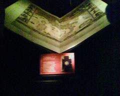
[2] The image is illegal, taken by cameraphone before I saw the “no photography” sign, of an Italian book of maps, c. 1665, that, had it been standing, would have stood as tall as me -- and I’m 5 foot 12.
[3] Have you ever heard anything like it -- that clear blue chime that an eagle makes when it’s calling to its mate? I heard it once on Christmas Day walking through Seward Park in Seattle and it took me several disorienting minutes to realize that what I heard was a living breathing creature.


1 comment:
I will have to come back, I'm starting to hyperventilate
Post a Comment